Los drones en la Policía Municipal de Madrid
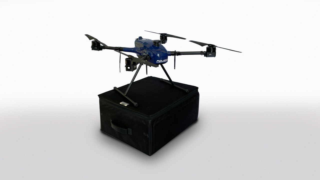
The Madrid Municipal Police uses 23 drones with specialized cameras for three-dimensional accident reconstruction and emergency support.
- Interviewee
- Policía Municipal de Madrid · Policía Municipal · Policía Municipal de Madrid
- Category
- Digitalización y documentación 3D
- Published
- 2023-04-17
Interview with the Municipal Police Aerial Support Section.
Pedro Ortega: First of all, I would like to ask you when the idea of providing the Municipal Police with the means to create virtual reality emerged and what the objectives of your unit are.
Municipal Police: The aerial means equipped by the Aerial Support Section of the Municipal Police Force were never intended or proposed for the creation of virtual reality. Their purpose closest to virtual reality was the three-dimensional reconstruction of traffic accidents, which was expanded based on needs detected by different specialized units such as the Environment Unit (reconstruction and measurement of contaminated scenarios and waste volume measurement) or the Judicial Investigation and Coordination Unit (reconstruction of workplace accident scenarios such as those occurring on Toledo Street or Ayala Street).
The Section was created with the aim of keeping the Municipal Police Force at the technological forefront given its status as the state capital and as a European capital with the largest local police force in Europe, after demonstrating its effectiveness during the pandemic.
PO: Perhaps the instruments that draw the most attention from your team are the drones: how many do you have and what type are they?
PM: The Section's aerial equipment includes 23 drones of different sizes and characteristics, covering all cases occurring in emergencies—not only police-related, but also civil protection, fire, health, disasters, etc. For all this, drones of different sizes are available (to carry different accessories or payloads and resist weather conditions), as well as indoor drones, tethered drones, hybrids, etc.
PO: But drones need to have cameras. I believe you even have infrared cameras. What types of cameras do you work with and what is the use of each? Do you also use other equipment such as 3D scanners?
PM: Regarding the payloads for the drones, we have visible spectrum cameras with high zoom, thermal cameras to measure temperatures and detect heat sources, and infrared/night vision cameras to facilitate vision without light. Additionally, we have specific cameras for three-dimensional reconstructions with fixed lenses (Sony A7rii). At the moment, we are not equipped with 3D scanners since our police functions do not require the level of detail that would necessitate reinforcing with a ground scanner.
PO: Ultimately, this equipment helps you perform photogrammetry. Could you give us an example of how you use them in the daily work of the Municipal Police? What software do you use in these cases?
PM: The use of photogrammetry applied to the police field allows us to improve police work in both prevention and investigation in the following ways:
· It allows for the recording of a scene of police interest (for example, a traffic accident or a building explosion) with a precision of up to a few centimeters in a very short time, so that even if that scene disappears, a reconstruction of how it was found always remains.
· When presenting an investigation for road accidents or other types to a judge, it adds a professional edge to police work, in addition to improving efficiency (reducing times compared to manual sketching).
· It allows for various calculations to fulfill investigative or administrative police duties, such as calculating waste volumes or measuring occupation surfaces on public roads.
· Creation of orthophotographs for event planning, as well as collaborating with different urban discipline departments of the city council within our administrative police duties.
· With these calculations, crowd sizes in problematic environments can be estimated to improve public safety.
To perform photogrammetry, we use software from the company pix4d, with several licenses for pix4dmapper, as well as the pix4dreact suite for emergencies, the latter being a gift from the company to the Municipal Police Force.
PO: I also wanted to ask if the digital twins you create are geolocated, that is, if you use any Geographic Information System to locate them.
PM: The reconstructions carried out are always geolocated. Depending on the work to be done, they are geolocated with greater or lesser precision.
For example, for the reconstruction of a road accident, it is necessary to have exact geopositioning, as the interest lies in respecting the measurements of the reconstruction elements (relative error), while the actual position on Earth (absolute error) is indifferent. However, for urban applications such as creating cartography, it is vital to reduce that absolute error, which is why reconstructions are supported by the two centimeter-precision GPS units we have available.
PO: I know firsthand that your drone flights have also served to record aerial videos of the city of Madrid. For example, those flying over the Paisaje de la Luz (a World Heritage site around Paseo del Prado and El Retiro), which are shown at the Centro de Interpretación in the Palacio de Cibeles. Have you recorded more videos with drones for other municipal departments?
PM: The municipal police force carries out a large number of surveillance flights per year, in which spectacular images of monuments, parks, and other emblematic sites are obtained. These have been useful for the Paisaje de la Luz project as well as for other government areas such as Culture or Urban Development, in addition to our own Department of the Spokesperson, Security, and Emergencies.
PO: With the equipment you have, it would be feasible to carry out 3D surveys of heritage areas. Do you think you could collaborate with other municipal departments to carry out projects for the creation of digital twins of spaces like the Paisaje de la Luz?
PM: Of course. With the equipment available to the Aerial Support Section of the Madrid Municipal Police Force, large areas could be surveyed, as well as the necessary buildings and monuments. Always keeping in mind that our activity and means are focused, as our own name indicates, on aerial work, and not ground scanning (since at the moment we do not have such equipment).
PO: As I do in all my interviews, I would like to ask for your point of view on the Metaverse, in this case regarding security: What implications for a citizen's safety could entering a Metaverse have? Have you already thought about what the role of the Municipal Police could be if a part of Madrid entered the Metaverse and a crime was committed there? Is there already something planned, such as a virtual police station in the Metaverse?
PM: From my particular point of view, I believe the Metaverse, no matter how immersive it becomes, will never stop being something fictitious. Security in this regard will have nothing to do with real police activity; however, other types of crimes associated with virtual environments will occur, with cybercrime being very present. Police activity today will focus on possible cybercrimes committed in connection with the use of the Metaverse, such as scams or computer damage, and virtual police stations are not being considered.
PO: Thank you very much for your participation